
Day 3. Mount Kitamata and sunrise

The date and time is 5:20 AM on October 4. The twilight is coming. There is no morning that is not bright. We are full of hope today.
I was in a daze and realized that it was less than 30 minutes before sunrise. We had planned to watch the sunrise at the summit of Mount Kitamata, but it would take 50 minutes according to the course time. I wondered if I would make it in time.

Mount Kitamata. Kairagi hut is located on the saddle, so you will not be able to see the surrounding landscape illuminated by the morning sun until you reach the summit.

We arrived at the summit of Mount Kitamata. We were able to reach the summit in 20 minutes instead of the course time of 50 minutes. This is the moment when I showed my mettle as a self-proclaimed photographer.

We arrived just in time for sunrise!

Oguni Town is welcoming the morning.

The sun’s altitude is getting higher.

Torii gate and sunrise.
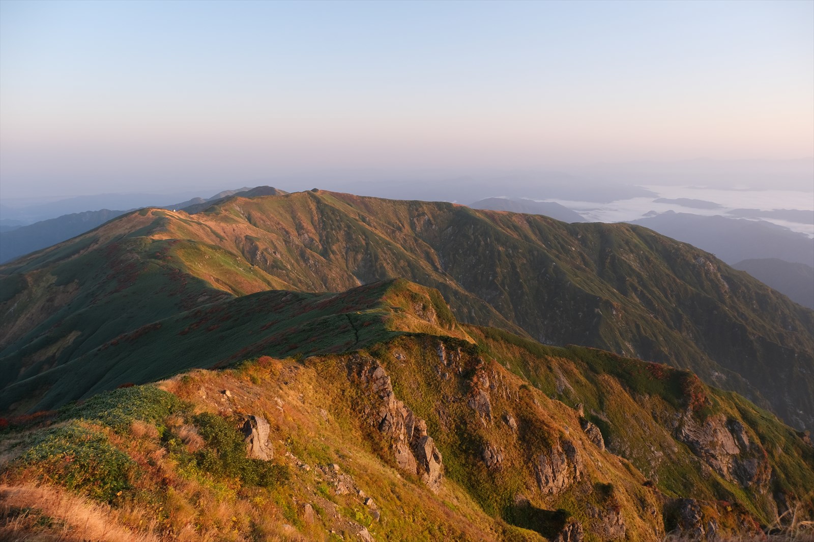
The ridgeline that we will traverse today is also reddish. It is difficult to distinguish whether the grass leaves themselves are red or whether the morning sun is turning them red.

Mount Kitamata’s shadow is formed. It is interesting.
Mount Monnai and Monnai hut

Next, we will be heading for Mount Monnai and the Monnai hut.

We have traversed a long distance and the surrounding landscape has changed. We can see the Niigata Thermal Power Plant of Tohoku Electric Power Co. and the Sea of Japan beyond.

The building in the center of the photo is Monnai hut. The red roof on the left is the summit of Mount Monnai.
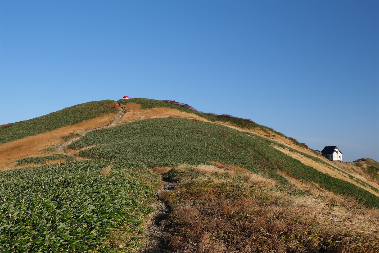
We are almost to the summit.

We arrived at Mount Monnai (1,887 meters above sea level)!

We will refill our water at the water station at Komonai Hut. It is a 10-minute round trip.

The path to the water hole is difficult to find due to multiple steps. To the right is the tent site of the Monnai hut, and from here the path to the watering hole goes to the back left. This time, there was a pink tape, so we followed it.

The water comes out of the hose in abundance. It tastes very good.
Click here for information on Kadonai Shimizu.
Last peak, Mount Jigami

Next we proceeded to Mount Jigami.

Around this area, red autumn leaves became conspicuous again. (Between Mount Monnai and Mount Eboshi, we did not see many red leaves.)

Mount Tainai.

It is a walk along a ridge with wonderful autumn foliage.

This is the Kajikawa-ridge extending east from Ougi-no-jigami. Kajikawa-ridge can be used to descend to Iide hut, the descent point this time. On the other hand, this time we would like to see the autumn colors of Mount Eburisashi, so we will descend to Iide hut from Marumori hut, which is located more to the north of the mountain. The course time will only increase by 20 minutes.

The density of red autumn leaves is clearly increasing.

Wonderful autumn leaves. Words are no longer necessary.
I’ve seen too many autumn leaves and I’m feeling uplifted.

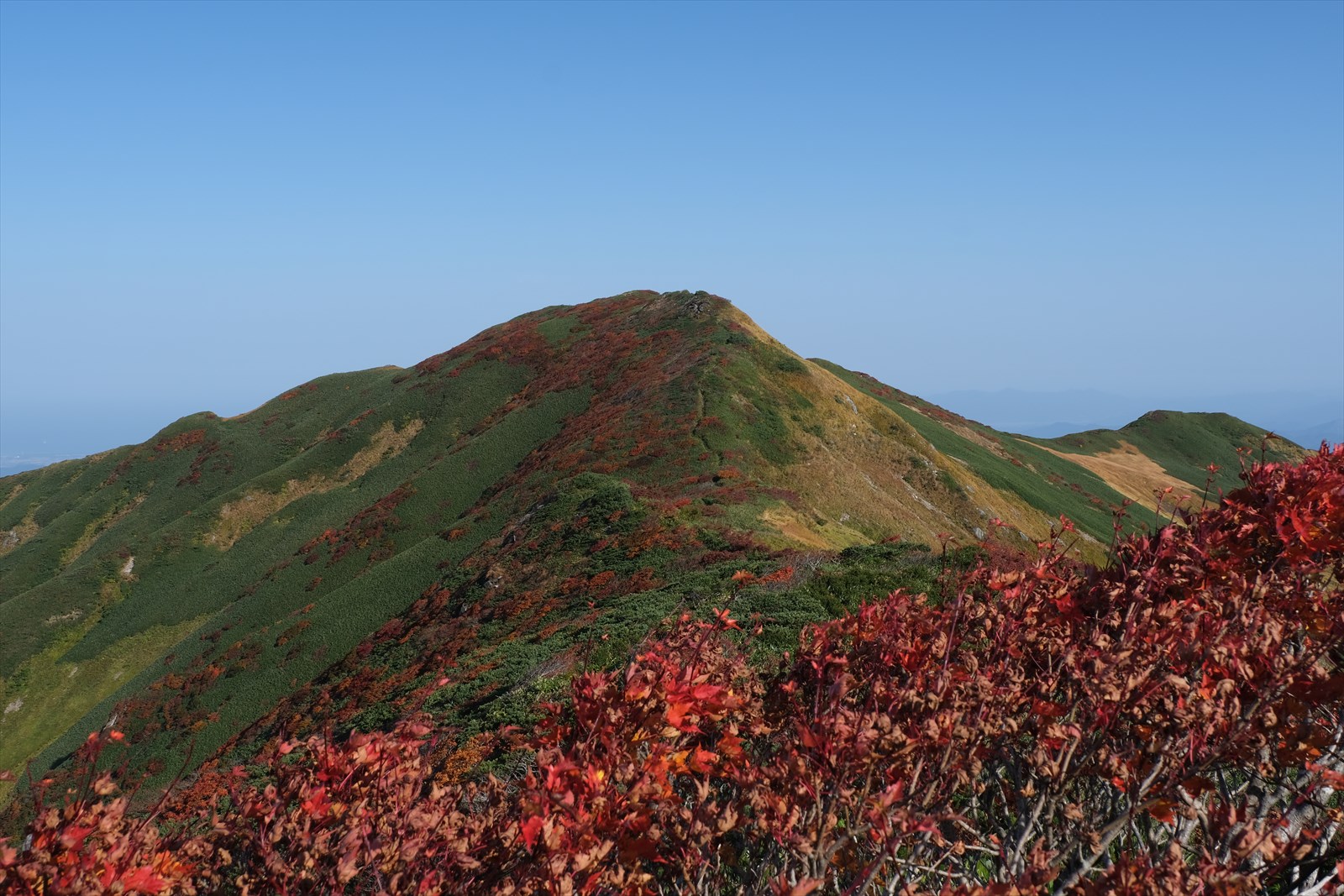
The peak at the far right is Mount Jigami.

We caught sight of the summit sign.

We arrived at Mount Jigami (elevation 1,849 meters)! This is the last peak of this mountain climbing trip. It is a very emotional moment.
Mount Eburisashi and spectacular views of the autumn leaves

We descend to Jigami’s north peak at the junction.

This is Jigami’s north peak.

From the north peak of Mount Jigami, we can see the autumn leaves around Mount Eburisashi! It is a reward for the long ridge walk. We are glad we hiked this far.

Yorimogi Hut and autumn leaves.

Eburisashi hut and the Sea of Japan. It would be fun to add one more night at Eburisashi hut and descend to Oishi dam.
Descending the difficult Marumori ridge

We descended Marumori hut and went down to Iide hut.

Marumori hut is a general route, but it is quite rough. As you can see in the photo above, the gullies are just the beginning.

What seems like a beautiful descent with the autumn leaves, soon becomes less and less time to take in the scenery.

We descend on rocky terrain with no chains or ropes attached. However, it is not too difficult here because the holds are solid.

It’s a downhill slope of about 45 degrees, and the rock surface is rounded, making it very slippery.

The steps on the trail are large; about 1 meter is just the beginning.

They climb over numerous steps as high as a person’s height.

A short break while viewing the autumn leaves.

It is hard to tell from the photo, but the trail traverses right next to a sheer cliff. This is a nerve-wracking part of the trail.

We have reached the junction of Fuufu clear water. To the left is the trail. To the right is Fuufu clear water.

The road down to Fuufu clear water is not that rough.

Water is available. There were many winged insects at the watering hole, so those who do not like them may want to fetch water at the top.

We descend two rocky sections, each about 10 meters high. The holds are solid, but it is dangerous unless you climb down (belly down on the mountain side). There are no chains or ropes.
Incidentally, Kajikawa-ridge, which runs parallel to Marumori ridge, which we are currently descending, is said to be rough to the same degree. Therefore, there is no significant difference regardless of which one you choose. In terms of enjoying the view of the main ridge for a longer time, I would recommend Marumori ridge.

We arrived at the trailhead of Iide hut! As usual, I am happier than when I stepped on the summit. Tired…

As of October 4, 2021, Iide hut has suspended day-trip bathing due to equipment failure. This time, we will be visiting hot spring of Kairakgi house. The bath is free-flowing hot-spring water and the fee is only 500 yen, which is very reasonable.

We get into the car and leave Iide hut. We drive a little over an hour to Yonezawa Station.

This time of year, mushrooms are sold everywhere in Oguni Town. This time, I purchased mushrooms at Mori no Megumi Direct Sales.
Mount Iide in its peak foliage season, which had been a longtime dream of ours. That is all for this article.


